
Dec 3, 2025

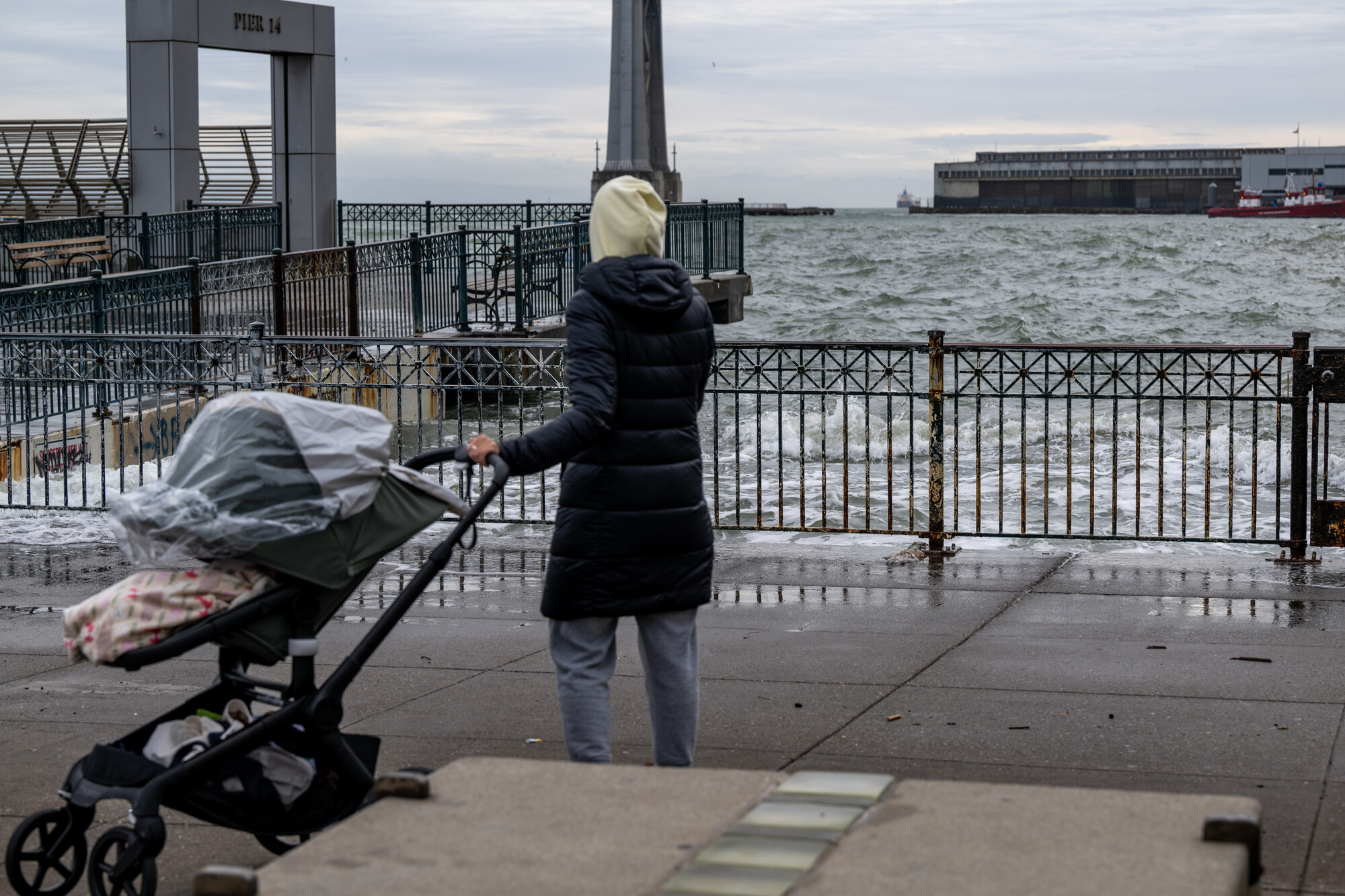
People walk along the Embarcadero during a high king tide in San Francisco on Dec. 13, 2024. This week’s extra high tide could flood shorelines across the Bay Area, offering a preview of how rising seas could reshape the region. (Beth LaBerge/KQED)
Beachgoers across the Bay Area and the coast are in for some of the highest tides of the year this week.
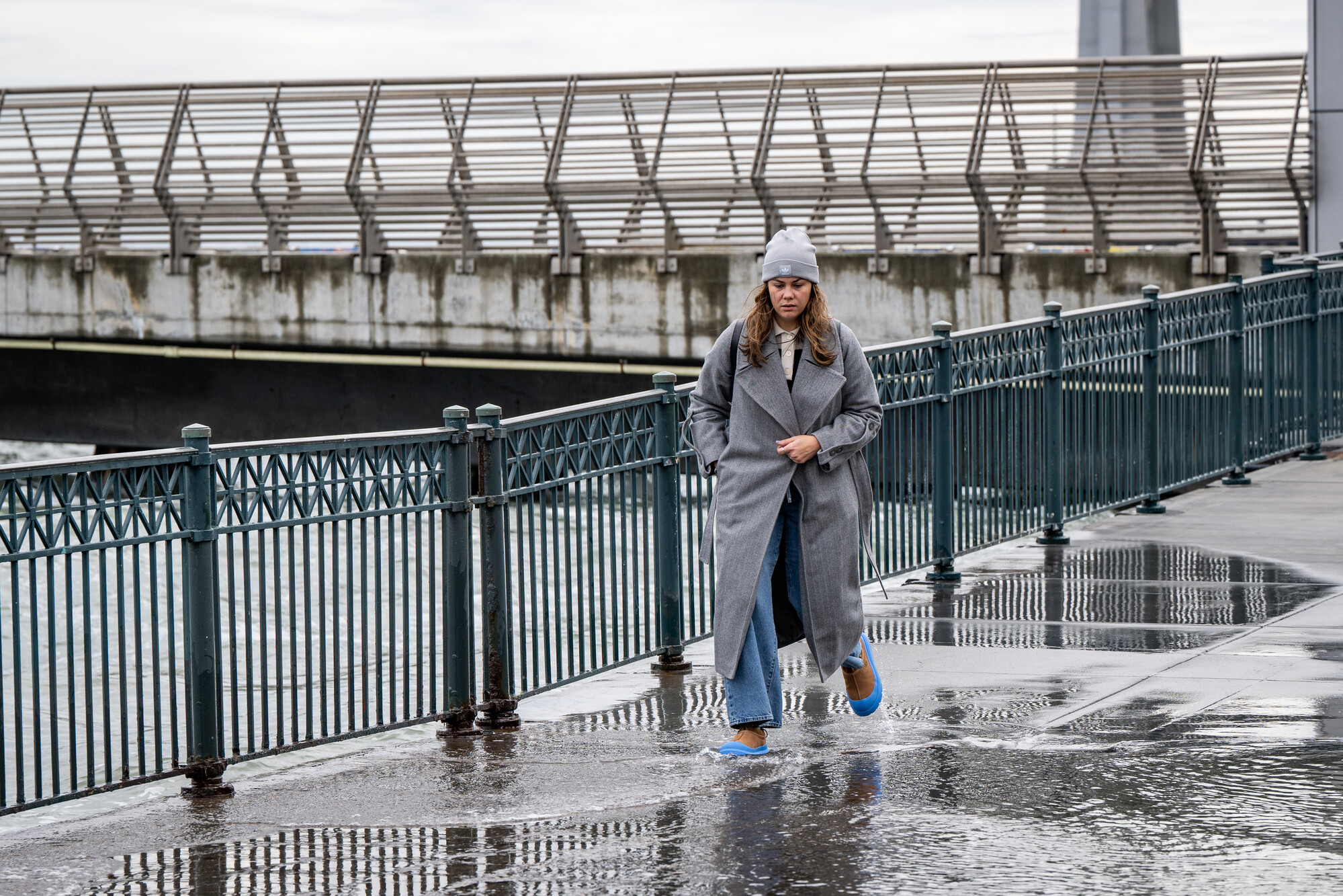
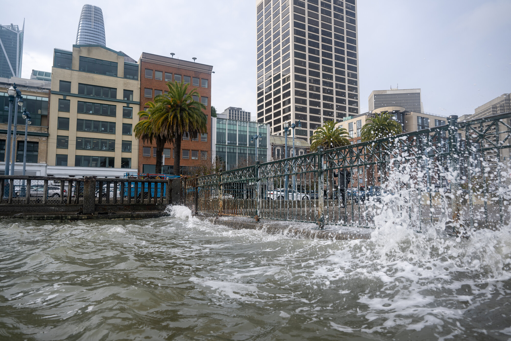
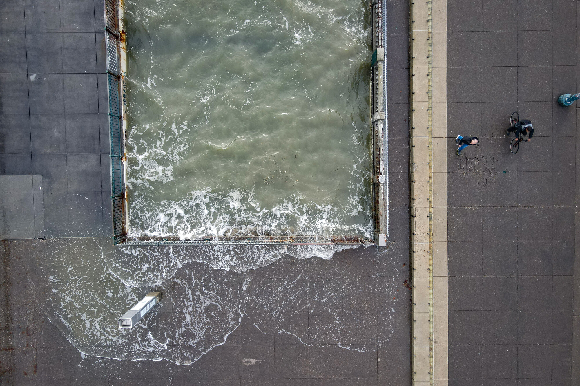
King tides — caused by a stronger-than-normal gravitational pull when the sun, moon and Earth align — could push water onto low-lying areas. Parts of Highway 101 in Marin County often flood during these events, as do communities like San Rafael and San Francisco’s Embarcadero.
At the other end of the tidal cycle, tidepoolers can expect some of the lowest astronomical tides of the year, too.
The negative low tide can unveil submerged rocky habitats and species usually hidden from onlookers. Beachgoers can glimpse urchin, algae, California muscles, and — if they are lucky — octopuses and other creatures, said Erin Hubach, an interpretive programs specialist with the Monterey Bay Aquarium.
The tidal extremes will build through Friday, before slowly returning to normal this weekend into next week. The National Weather Service’s Bay Area office issued a coastal flood advisory for minor flooding due to high tides from Tuesday through 3 p.m. Sunday for communities along San Francisco Bay, San Pablo Bay and Monterey Bay. Forecasters said that the tides and high surf through Wednesday could lead to unexpected sneaker waves and advised taking caution when visiting the coastline.
The California King Tides Project, a citizen science project tracking the impact of rising sea levels, encourages people to send photos of the high tides as part of an ongoing citizen science project. Manager Annie Kohut Frankel said the images will help planners, researchers and communicators understand current coastal vulnerabilities and how severe sea level rise could inundate areas in the coming decades.
“There are places that are already impacted by these extremely high tides,” Kohut Frankel said. “For our project, if you know of a place that floods, we appreciate you going and taking a photo of it.”
Today, California’s king tides mainly cause ponding on roads and other short-term nuisance flooding. However, scientists point out that they foreshadow a far wetter future due to sea-level rise caused by human-caused climate change. Climate scientists predict that melting ice caps and expanding ocean waters could cause the seas to rise anywhere between a foot by 2050 and more than 6 feet by the end of the century.
‘We Cannot Wait Much Longer’: King Tides Foreshadow a Far Wetter Future for SF Shoreline
“It’s kind of a signal for the future,” said Dalton Behringer, a meteorologist with the National Weather Service’s Bay Area office. “If you’re flooding now, it’s not gonna get any better, certainly in the future.”
Some coastal areas have built tall flood protections to protect against future flooding, but not the Canal neighborhood in San Rafael. The city in Marin County is shaped like a bowl, and its makeshift levees, some constructed with plywood or concrete, and pumps are already struggling, said Carly Finkle, senior policy manager with the nonprofit Canal Alliance.
“Water will overtop and flow onto the streets in a couple of different areas,” Finkle said. Although she said sometimes the floodwaters impact “people’s cars and access to people’s homes.”
Finkle encourages the public to see for themselves how the higher-than-usual tides are already affecting communities like San Rafael. Canal Alliance, alongside the City of San Rafael and other groups, is hosting a tour on Saturday from 9 a.m. to noon.
“There’s really informal infrastructure that’s blocking the water,” Finkle said. “If those pieces of plywood keep keeping the water out as they have, then we shouldn’t see catastrophic flooding, but it’s also gonna be an important opportunity to go out and see how flimsy they are.”
A second round of king tides will occur in early January.
When will tides be the highest and lowest?
Weather Service forecasters said that in the San Francisco area, water could push more than a foot above the ground level in low-lying areas. They also note that high tide varies by about 90 minutes, and high surf could exacerbate the flooding. The highest chance of flooding is on Thursday and Friday morning.
To find out the exact times of low and high tides, use the National Oceanic and Atmospheric Administration’s tide predictions online tool or other sites like tideforecast.com.
San Francisco high tides:
- Tuesday at 8:24 a.m.
- Wednesday at 9:04 a.m.
- Thursday at 9:48 a.m.
- Friday at 10:35 a.m.
- Saturday at 11:25 a.m.
- Sunday at 12:17 a.m.
San Francisco low tides:
- Tuesday at 3:15 p.m.
- Wednesday at 4:02 p.m.
- Thursday at 4:50 p.m.
- Friday at 5:40 p.m.
- Saturday at 6:30 p.m.
- Sunday at 8:12 p.m.
What to know about visiting the water’s edge
Coastal experts suggest caution. At high tides, visitors should pay close attention to where they park to make sure their cars aren’t flooded. At low tide, experts advise explorers to wear waterproof, non-slippery shoes, a head lamp and always head out with a buddy.
Hubach, with the Monterey Bay Aquarium, said to always pay close attention to the ocean in case a big wave sneaks up. She also said the lowest tides are occurring around dusk and into the early evening, so be extra careful when walking on coastal reefs.
“Watch for big waves and watch where you step, not only for the slippery factor of the rocks, but also because there might be animals hidden underneath things,” Hubach said.
She said there’s a bonus of visiting tide pools when it’s dark outside: “Sometimes different animals hang out in the tide pools at night versus during the daytime.”
Tides can seemingly rise fast or unexpectedly when you are having a good time looking at critters usually unseen, she added.
“The important thing is to take only pictures, take memories with you, and leave only footprints,” Hubach said.
Where to see king tides and low tides
While ocean visitors can see the impact of the high and low tides all around the rim of the bay and edge of the sea, a number of official outings are taking place across the region this week.
Thursday, Dec. 4:
San Francisco: After Dark: Royal Tides at the Exploratorium, Pier 15 (Embarcadero at Green Street), 6-10 p.m. Learn about how king tides shadow a future with human-caused climate change, and how coastal communities are responding to sea level rise.
Friday, Dec. 5:
Pescadero: King Tides and Marsh Trails at Pescadero State Beach
Central Pescadero Beach Access Parking Lot, Pescadero, San Mateo County 9 a.m. Organizers discuss coastal resilience before a trail walk into the marsh.
Saturday, Dec. 6:
San Rafael: High Tide Day, 711 Grand Avenue, 9 a.m. to noon. The City of San Rafael and a number of local organizations will provide community science kits to explore how low-lying spots along the waterfront are affected by high tides.
San Rafael: King Tides in China Camp at China Camp State Park, Marin County, Turtle Back Trailhead off of North San Pedro Road from 10 a.m. to 1 p.m. Friends of China Camp hosts a tabling event to explore how these extreme high tides give us a glimpse into the future of sea level rise.
Alameda: King Tide at the Cove from 11:30 a.m. to 12:30 p.m. Doug Siden Visitor Center at Crab Cove, 1252 McKay Avenue, Alameda. The Oakland Alameda Adaptation Committee and the East Bay Regional Parks District host a watch party at the marine protected area.
Palo Alto: King Tides Walk from 11:30 a.m. to 1:30 p.m. EcoCenter, 2560 Embarcadero Road, Palo Alto. The event will include a science talk about tides and a walk through the Baylands.
Alviso and Menlo Park: December 2025 King Tides in Alviso at Don Edwards San Francisco Bay National Wildlife Refuge. 1751 Grand Blvd., Alviso, Santa Clara County. Noon to 1 p.m. The San Francisco Bay Wildlife Society presents a free guided walk to discover the highest tides of the year. Register here for the Menlo Park location.
Pescadero: King Tides and Marsh Trails at Pescadero State Beach
Central Pescadero Beach Access Parking Lot, Pescadero, San Mateo County 9:30 a.m. Organizers discuss coastal resilience before a trail walk into the marsh.